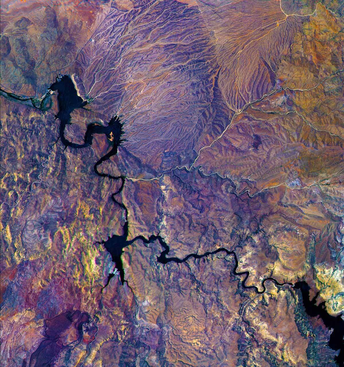
Xplore Hyperspectral satellite image of the Salt River in Arizona, ©2025 Xplore Inc. All rights reserved
Bellevue, WA - June 10, 2025 - Xplore Inc., a pioneering dual-use satellite data company, today unveiled the first hyperspectral imagery produced by its initial satellite, XCUBE-1. This release marks the first public revelation of the exceptional detail and clarity of images produced by Xplore’s satellite, a critical component in the company's planned constellation of multi-sensor satellites offering actionable intelligence through data fusion and edge computing. In its early operational life, the company’s satellite is capturing world-leading 5-meter spatial resolution hyperspectral imagery across a broad array of spectral bands.
Xplore’s satellite platforms are optimized for diverse use cases, catering to a wide range of application requirements across defense, intelligence, agriculture, forestry, finance, insurance, and environmental monitoring. Xplore’s flexible data acquisition capability can simultaneously deliver critical, actionable data for Earth observation, maritime domain awareness, and space domain awareness customers.
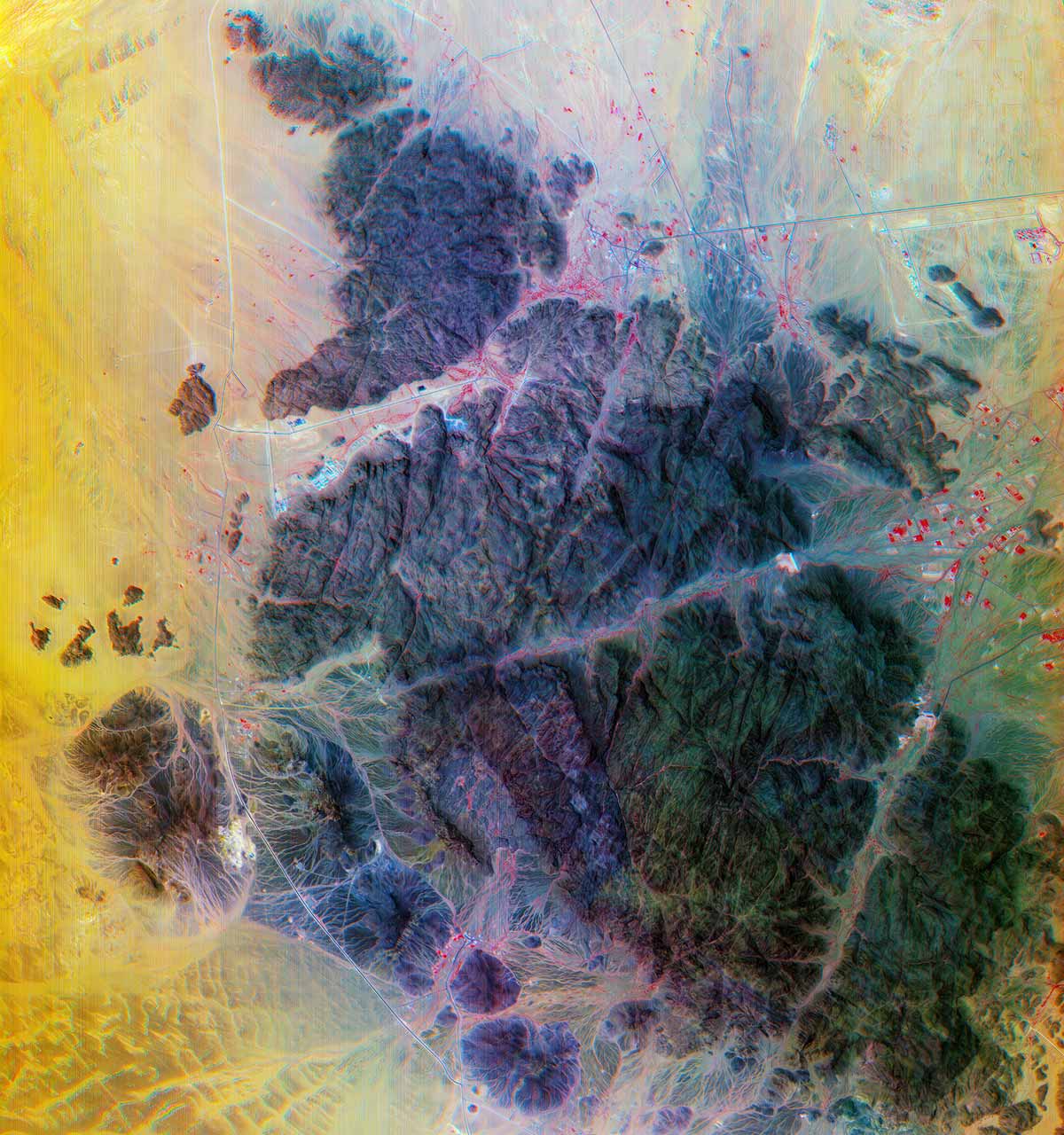
Xplore Hyperspectral satellite image of An Nabhaniyah, Saudi Arabia, ©2025 Xplore Inc. All rights reserved
When tasked for Earth Observation, Xplore’s hyperspectral images provide the raw data needed for our analytics partners to deliver the insights that end users need for their applications. For defense and intelligence users, hyperspectral data can provide key information for Intelligence, Surveillance and Reconnaissance (ISR) missions for the warfighter. The ability to see disturbed soil to find newly laid minefields or see through camouflage are some of the uses of hyperspectral data. A wide array of precision agriculture applications can significantly increase crop yield and optimize resource management through a granular understanding of soil quality, moisture levels, nutrient requirements, pest infestation, fertilizer run off, among other environmental metrics. For forestry and wildfire prevention, Xplore’s hyperspectral data can be used with advanced software from our partners to accurately identify tree and crop species, assess vegetation health and moisture content, and precisely map critical fire sources such as thick canopies and deadwood.
Our imagery is outperforming expectations, and its exceptional quality stems from the sophisticated ground calibration of our instruments and data processing pipeline.
— Jeff Rich, Xplore Founder and CEOFor maritime domain awareness, Xplore’s hyperspectral imagery enables end-users to create spectral signatures of individual vessels. These spectral signatures allow ships to be identified and matched when their AIS beacons are off, significantly aiding in the prevention of illegal fishing, dumping, trafficking, and other illicit activities.
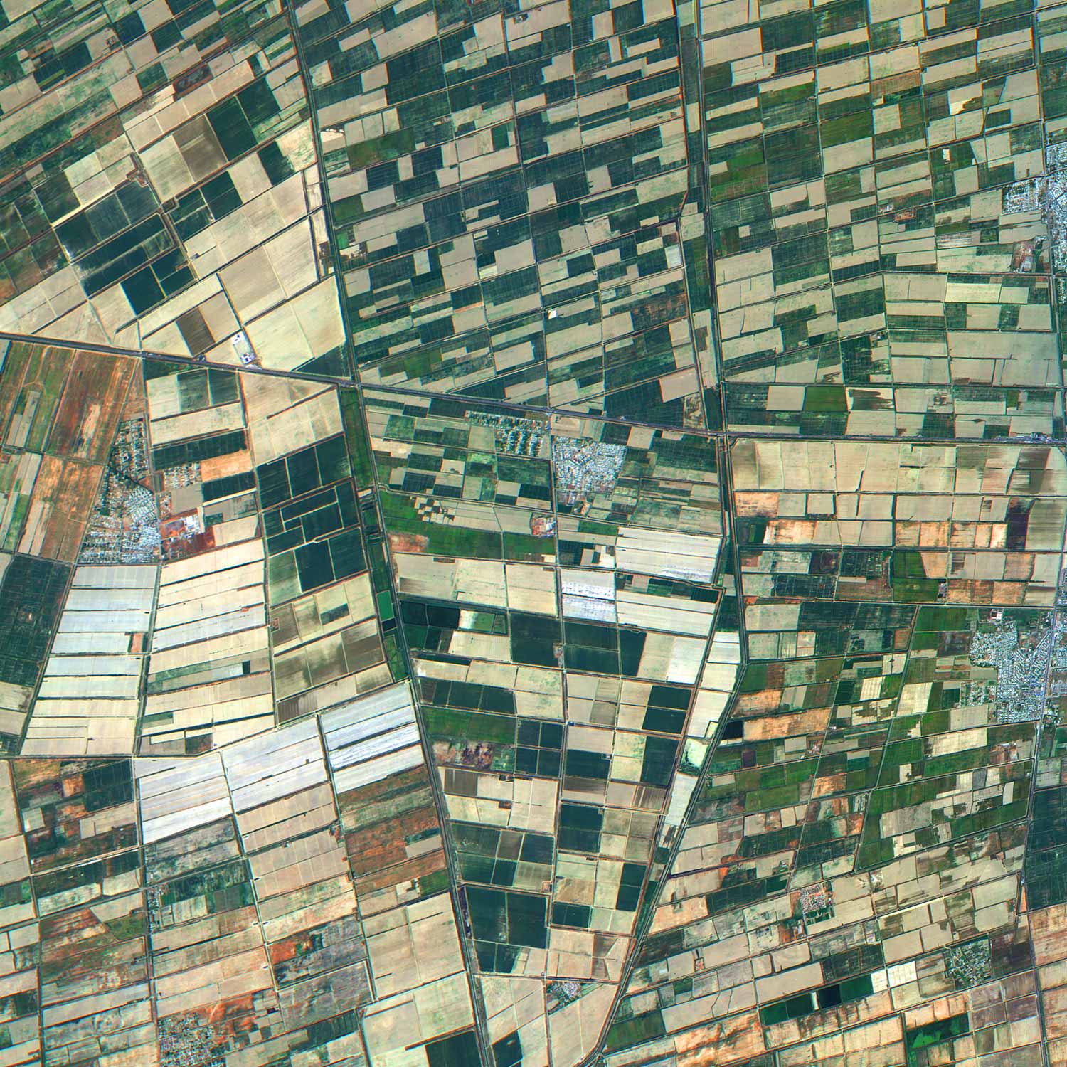
Xplore Hyperspectral satellite image of farmland in Uzbekistan, ©2025 Xplore Inc. All rights reserved
For space domain awareness Xplore is licensed to collect images of other satellites in orbit. During close conjunctions, Xplore can image at very high resolution, and equally important, collects a spectral signature on the other orbiting asset. There is an important need to monitor adversarial satellites for the US and allied defense and intelligence agencies. In addition to satellite monitoring, our capability will also assist in space traffic management by identifying unknown objects in government and commercial catalogs of known space objects. Items like old rocket boosters and fairings can be identified by their material properties through Xplore’s hyperspectral data products.
"Xplore is focused on providing high-quality data products for our customers and partners," said Jeff Rich, Founder and CEO of Xplore. "Our imagery is outperforming expectations, and its exceptional quality stems from the sophisticated ground calibration of our instruments and data processing pipeline. We expect demand for high-quality hyperspectral imagery to expand rapidly in multiple domains. As customers ingest it into their systems, this powerful decision-making tool will reveal a depth of information they may never have expected."
We’re thrilled with Xplore’s progress and are thankful for our talented team and partners. Their hard work and dedication are clearly reflected in the outstanding imagery we’re producing
— Lisa Rich, Xplore Founder and COOHyperspectral imagery unlocks a profound depth of information, revealing the unique spectral signatures of environments, objects, satellites, and more. These hyperspectral data products, combined with advanced software processing tools, enable quantitative analysis of targets for end users. This unprecedented wealth of data transforms an image into an indispensable tool for intelligence, commercial advantage, scientific discovery, and environmental monitoring. Since launch, Xplore has been sharing its initial data and exploring use cases with key customers and partners.
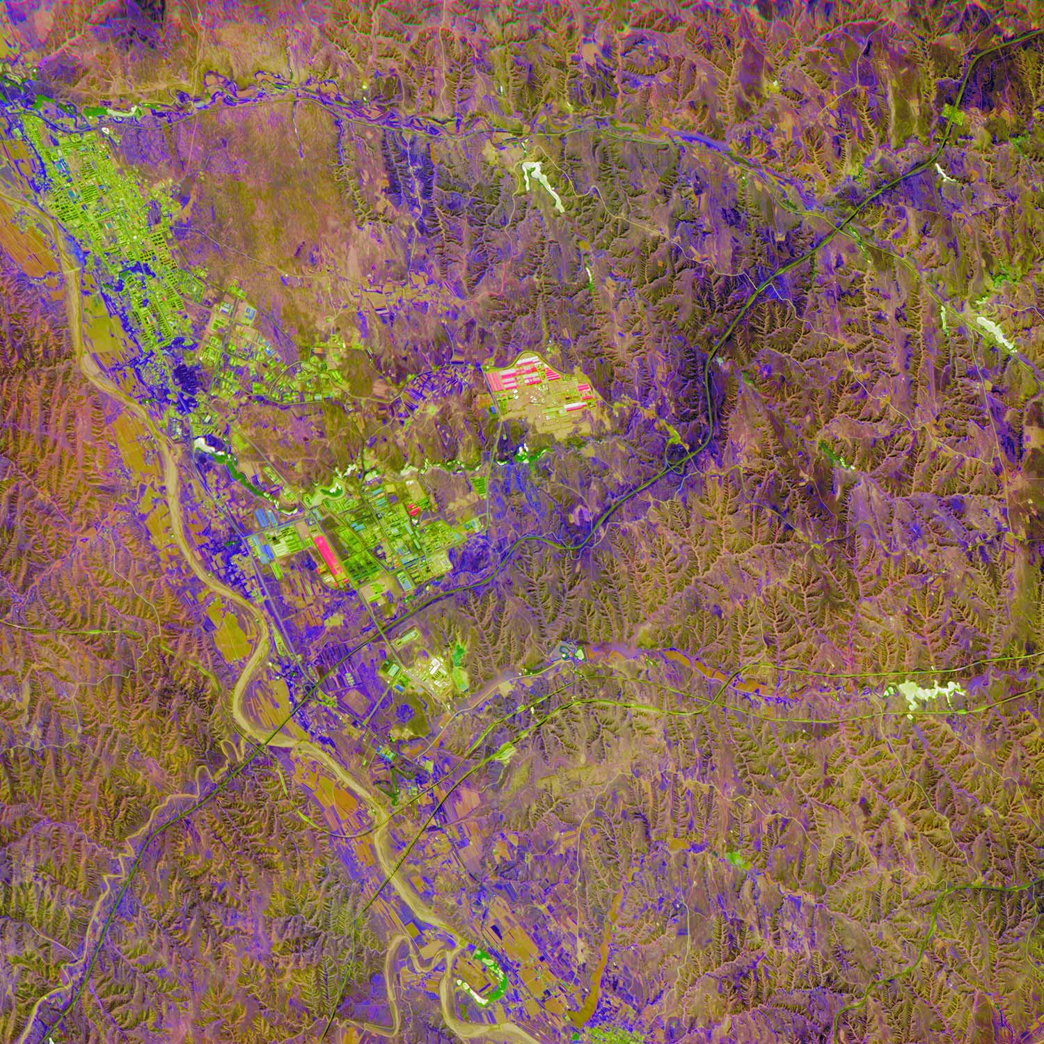
Xplore Hyperspectral satellite image of Inner Mongolia, China, ©2025 Xplore Inc. All rights reserved
Founder and COO Lisa Rich added: "We’re thrilled with Xplore’s progress and are thankful for our talented team and partners. Their hard work and dedication are clearly reflected in the outstanding imagery we’re producing. We now invite customers to request data samples to assess our data for their programs and projects. The use of these data products will be crucial to produce insights, perform change detection, and identify anomalies that are critical to our customers’ applications.”
About Xplore
Xplore is an early-stage, venture-backed space company based in Bellevue, Washington. Xplore delivers insights, intelligence, inspiration, discovery from the data products produced from their satellite constellation. The company’s planned constellation of satellites will carry remote sensing instruments including hyperspectral, video, radio-frequency monitoring, and other sensors, to produce valuable data and insights for customers. Additionally, its edge computing capability enables the creation of data fusion products and insights to be extracted on-orbit, reducing latency and data transmission costs. Visit: https://www.xplore.com
Back to Press